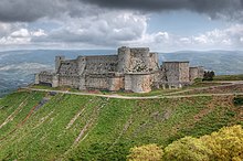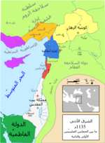
تعتبر من أجمل قلاع العالم الأثرية، تقع في منطقة تلكلخ من محافظة حمص. ويعتقد بإقامتها فوق أطلال قلعة أقدم منها كان اسمها «شبتون» أقامها الفراعنةعندما هاجموا سورية بقيادة رعمسيس الثاني في القرن الخامس عشر قبل الميلاد.
أول إشارة تاريخية للقلعة الحالية تؤكّد أن أمير حمص “شبل الدولة المرداسية نصر بن صالح المرداسي” وضع أساساتها عام 1031م أثناء صراعه والفرنجة، ومنذ ذلك الحين شغلتها حامية كردية…
احتلها الفرنج عام 1110م ووسعوها ودعّموا منشآتها لمصالحهم، وأقاموا فيها إلى أن حررها الملك الظاهر بيبرس في العصر المملوكي عام 1271م.
تضررت القلعة عدة مرات نتيجة للزلازل، كما خضعت للترميم أكثر من مرة.
وهي من أفضل التحصينات الفرنجية في الشرق وأكثرها حفظاً، وتتألف من قلعتين متحدتي المركز، الخارجية منهما يحيط بها سور دفاعي مقوى بأبراج نصف دائرية. وتتألف القلعة الداخلية من أبراج ضخمة تشرف على القلعة الخارجية من فوق المنحدر الذي بُنيت عليه.
— مع Zuka Ezzat Alkahhal وMoussa El-Khoury وAbd Alwhab Abu Salh

Krak des Chevaliers
Jump to navigationJump to search
| Krak des Chevaliers | |
|---|---|
|
قلعة الحصن
|
|
| Talkalakh District, Syria | |
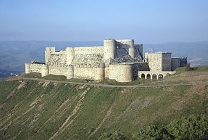
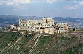
Krak des Chevaliers from the southwest
|
|
| Coordinates | 34.7570°N 36.2947°ECoordinates: 34.7570°N 36.2947°E |
| Type | Concentric castle |
| Site information | |
| Controlled by |
|
| Open to the public |
Accessible |
| Condition | Mostly good but damaged due to Syrian Civil War |
| Site history | |
| Built |
|
| Built by |
|
| Materials | Limestone |
| Battles/wars | |
| Part of | Crac des Chevaliers and Qal’at Salah El-Din |
| Criteria | Cultural: ii, iv |
| Reference | 1229-001 |
| Inscription | 2006 (30th session) |
| Endangered | 2013 – present |
| Area | 2.38 ha |
| Buffer zone | 37.69 ha |
Krak des Chevaliers (French pronunciation: [kʁak de ʃəvaˈlje]; Arabic: قلعة الحصن), also called Crac des Chevaliers, Ḥiṣn al-Akrād (حصن الأكراد, literally “Fortress of the Kurds”), and formerly Crac de l’Ospital, is a Crusader castle in Syria and one of the most important preserved medieval castles in the world. The site was first inhabited in the 11th century by a settlement of Kurdish troops garrisoned there by the Mirdasids. In 1142 it was given by Raymond II, Count of Tripoli, to the order of the Knights Hospitaller. It remained in their possession until it fell in 1271.
The Hospitallers began rebuilding the castle in the 1140s and were finished by 1170 when an earthquake damaged the castle. The order controlled a number of castles along the border of the County of Tripoli, a state founded after the First Crusade. Krak des Chevaliers was among the most important, and acted as a center of administration as well as a military base. After a second phase of building was undertaken in the 13th century, Krak des Chevaliers became a concentric castle. This phase created the outer wall and gave the castle its current appearance. The first half of the century has been described as Krak des Chevaliers’ “golden age”. At its peak, Krak des Chevaliers housed a garrison of around 2,000. Such a large garrison allowed the Hospitallers to exact tribute from a wide area. From the 1250s the fortunes of the Knights Hospitaller took a turn for the worse and in 1271 Mamluk Sultan Baibars captured Krak des Chevaliers after a siege lasting 36 days, supposedly by way of a forged letter purportedly from the Hospitallers’ Grand Master that caused the Knights to surrender.
During the Ottoman period (1516–1918), the Crac housed a company of müstahfızan (equivalent to local janissaries) and was the centre of the nahiye (tax district) of Hısnülekrad, attached first to the sancak (province) of Tripoli and later Homs. The castle itself was commanded by a dizdar (castle warden). Several Turkmen and Kurdish tribes were settled in the area and in the eighteenth century the district was mainly controlled by the Dandashli family of local notables. In 1894 the Ottoman government considered stationing a company of redif (auxiliary) soldiers there revised its plans after deciding the castle was too old and access too difficult. As a result the capital of the district was then moved to Tall Kalakh.[1]
Renewed interest in Crusader castles in the 19th century led to the investigation of Krak des Chevaliers, and architectural plans were drawn up. In the late 19th or early 20th century a settlement had been created within the castle, causing damage to its fabric. The 500 inhabitants were moved in 1933 and the castle was given over to the French Alawite State, which carried out a program of clearing and restoration. When Syria declared independence in 1946, it assumed control.
Today, a village called al-Husn exists around the castle and has a population of nearly 9,000. Krak des Chevaliers is located approximately 40 kilometres (25 mi) west of the city of Homs, close to the border of Lebanon, and is administratively part of the Homs Governorate. Since 2006, the castles of Krak des Chevaliers and Qal’at Salah El-Din have been recognised by UNESCO as World Heritage Sites.[2] It was partially damaged in the Syrian civil war from shelling and recaptured by the Syrian government forces in 2014. Since then, reconstruction and conservation work on the site had begun. Reports by the UNESCO and the Syrian government on the state of the site are produced yearly.[3]
Etymology
The modern Arabic word for a castle is Kalaa (قلعة), but Krak des Chevaliers is known as a “Hisn” (حصن), or “fort”. This derives from the name of an earlier fortification on the same site called Ḥoṣn al-Akrād (حصن الأكراد), meaning “fort of the Kurds”.[4] It was called by the Franks (i.e. Crusaders) Le Crat and then by a confusion with karak (fortress), Le Crac.[5] Crat was probably the French version of Akrād, the word for Kurds. Note that historically, Arabic speakers referred to Crusaders inaccurately as “Franks” and “Latins” to distinguish them from Christian Byzantines as the Crusaders called local Muslims “Saracens.”[6] [7] [8] The actual historical Franks divided their empire in 843 and at no point invaded Asia.
After the Knights Hospitaller took control of the castle, it became known as Crac de l’Ospital; according to Guillaume Rey’s 1871 work, it was designated by chroniclers of the Crusaders as the Crac des Chevaliers (alternatively spelt Krak des Chevaliers), where Chevaliers is French for “Knight” (c.f. the English word cavalry).[9][a]
Location
The castle sits atop a 650-metre-high (2,130 ft) hill east of Tartus, Syria, in the Homs Gap.[11] On the other side of the gap, 27 kilometres (17 mi) away, was the 12th-century Gibelacar Castle (Hisn Ibn Akkar).[12] The route through the strategically important Homs Gap connects the cities of Tripoli and Homs. To the north of the castle lies the Jebel Ansariyah, and to the south Lebanon. The surrounding area is fertile,[4] benefiting from streams and abundant rainfall.[13] Compared to the Kingdom of Jerusalem, the other Crusader states had less land suitable for farming; however, the limestone peaks of Tripoli were well-suited to defensive sites.[14]
Property in the County of Tripoli, granted to the Knights in the 1140s, included the Krak des Chevaliers, the towns of Rafanea and Montferrand, and the Beqa’a plain separating Homs and Tripoli. Homs was never under Crusader control, so the region around the Krak des Chevaliers was vulnerable to expeditions from the city. While its proximity caused the Knights problems with regard to defending their territory, it also meant Homs was close enough for them to raid. Because of the castle’s command of the plain, it became the Knights’ most important base in the area.[13]
History
Origins and Crusader period
According to the 13th-century Arab historian Ibn Shaddad, in 1031, the Mirdasid emir of Aleppo and Homs, Shibl ad-Dawla Nasr, established a settlement of Kurdish tribesmen at the site of the castle,[15] which was then known as “Ḥiṣn al-Safḥ“.[16] Nasr restored Hisn al-Safh to help reestablish the Mirdasids’ access to the coast of Tripoli after they lost nearby Hisn Ibn Akkar to the Fatimids in 1029.[16] Due to Nasr’s garrisoning of Kurdish troops at the site, the castle became known as “Ḥiṣn al-Akrād” (Fortress of the Kurds).[15][16] The castle was strategically located at the southern edge of the Jibal al-Alawiyin mountain range and dominated the road between Homs and Tripoli.[15] When building castles, engineers often chose elevated sites, such as hills and mountains, that provided natural obstacles.[17]
In January 1099 on the journey to Jerusalem during the First Crusade, the company of Raymond IV of Toulouse came under attack from the garrison of Hisn al-Akrad, the forerunner of the Krak, who harried Raymond’s foragers.[18] The following day Raymond marched on the castle and found it deserted. The crusaders briefly occupied the castle in February of the same year but abandoned it when they continued their march towards Jerusalem. Permanent occupation began in 1110 when Tancred, Prince of Galilee took control of the site.[19] The early castle was substantially different from the extant remains and no trace of this first castle survives at the site.[20]
The origins of the order of the Knights Hospitaller are unclear, but it probably emerged around the 1070s in Jerusalem. It started as a religious order that cared for the sick, and later looked after pilgrims to the Holy Land. After the success of the First Crusade in capturing Jerusalem in 1099, many Crusaders donated their new property in the Levant to the Hospital of St John. Early donations were in the newly formed Kingdom of Jerusalem, but over time the order extended its holdings to the Crusader states of the County of Tripoli and the Principality of Antioch. Evidence suggests that in the 1130s the order became militarised[21] when Fulk, King of Jerusalem, granted the newly built castle at Beth Gibelin to the order in 1136.[22] A papal bull from between 1139 and 1143 may indicate the order hiring people to defend pilgrims. There were also other military orders, such as the Knights Templar, that offered protection to pilgrims.[21]
Between 1142 and 1144 Raymond II, Count of Tripoli, granted property in the county to the order.[23] According to historian Jonathan Riley-Smith, the Hospitallers effectively established a “palatinate” within Tripoli.[24] The property included castles with which the Hospitallers were expected to defend Tripoli. Along with Krak des Chevaliers, the Hospitallers were given four other castles along the borders of the state, which allowed the order to dominate the area. The order’s agreement with Raymond II stated that if he did not accompany knights of the order on campaign, the spoils belonged entirely to the order, and if he was present it was split equally between the count and the order. Further, Raymond II could not make peace with the Muslims without the permission of the Hospitallers.[23] The Hospitallers made Krak des Chevaliers a center of administration for their new property, undertaking work at the castle that would make it one of the most elaborate Crusader fortifications in the Levant.[25]
After acquiring the site in 1142, they began building a new castle to replace the former Kurdish fortification. This work lasted until 1170, when an earthquake damaged the castle. An Arab source mentions that the quake destroyed the castle’s chapel, which was replaced by the present chapel.[26] In 1163 the Crusaders emerged victorious over Nur ad-Din in the Battle of al-Buqaia near Krak des Chevaliers.[27]
Drought conditions between 1175 and 1180 prompted the Crusaders to sign a two-year truce with the Muslims, but without Tripoli included in the terms. During the 1180s, raids by Christians and Muslims into each other’s territory became more frequent.[28] In 1180, Saladin ventured into the County of Tripoli, ravaging the area. Unwilling to meet him in open battle, the Crusaders retreated to the relative safety of their fortifications. Without capturing the castles, Saladin could not secure control of the area, and once he retreated the Hospitallers were able to revitalise their damaged lands.[29] The Battle of Hattin in 1187 was a disastrous defeat for the Crusaders: Guy of Lusignan, King of Jerusalem, was captured, as was the True Cross, a relic discovered during the First Crusade. Afterwards Saladin ordered the execution of the captured Templar and Hospitaller knights, such was the importance of the two orders in defending the Crusader states.[30] After the battle, the Hospitaller castles of Belmont, Belvoir, and Bethgibelin fell to Muslim armies. Following these losses, the Order focused its attention on its castles in Tripoli.[31] In May 1188 Saladin led an army to attack Krak des Chevaliers, but on seeing the castle, decided it was too well defended and instead marched on the Hospitaller castle of Margat, which he also failed to capture.[32]
Another earthquake struck in 1202, and it may have been after this event that the castle was remodelled. The 13th-century work was the last period of building at Krak des Chevaliers and gave it its current appearance. An enclosing stone circuit was built between 1142 and 1170; the earlier structure became the castle’s inner court or ward. If there was a circuit of walls surrounding the inner court that pre-dated the current outer walls, no trace of it has been discovered.[33]
The first half of the 13th century has been characterised as Krak des Chevaliers’ “golden age”. While other Crusader strongholds came under threat, Krak des Chevaliers and its garrison of 2,000 soldiers dominated the surrounding area. It was effectively the center of a principality which remained in Crusader hands until 1271 and was the only major inland area to remain constantly under Crusader control during this period. Crusaders who passed through the area would often stop at the castle, and probably made donations. King Andrew II of Hungary visited in 1218 and proclaimed the castle the “key of the Christian lands”. He was so impressed with the castle that he gave a yearly income of 60 marks to the Master and 40 to the brothers. Geoffroy de Joinville, uncle of the noted chronicler of the Crusades Jean de Joinville, died at Krak des Chevaliers in 1203 or 1204 and was buried in the castle’s chapel.[34]
The main contemporary accounts relating to Krak des Chevaliers are of Muslim origin and tend to emphasise Muslim success while overlooking setbacks against the Crusaders although they suggest that the Knights Hospitaller forced the settlements of Hama and Homs to pay tribute to the Order. This situation lasted as long as Saladin’s successors warred between themselves. The proximity of Krak des Chevaliers to Muslim territories allowed it to take on an offensive role, acting as a base from which neighboring areas could be attacked. By 1203 the garrison were making raids on Montferrand (which was under Muslim control) and Hama, and in 1207 and 1208 the castle’s soldiers took part in an attack on Homs. Krak des Chevaliers acted as a base for expeditions to Hama in 1230 and 1233 after the amir refused to pay tribute. The former was unsuccessful, but the 1233 expedition was a show of force that demonstrated the importance of Krak des Chevaliers.[32]
In the 1250s, the fortunes of the Hospitallers at Krak des Chevaliers took a turn for the worse. A Muslim army estimated to number 10,000 men ravaged the countryside around the castle in 1252 after which the Order’s finances declined sharply. In 1268 Master Hugues Revel complained that the area, previously home to around 10,000 people, now stood deserted and that the Order’s property in the Kingdom of Jerusalem produced little income. He also noted that by this point there were only 300 of the Order’s brethren left in the east. On the Muslim side, in 1260 Baibars became Sultan of Egypt, following his overthrow of the incumbent ruler Qutuz, and went on to unite Egypt and Syria. As a result, Muslim settlements that had previously paid tribute to the Hospitallers at Krak des Chevaliers no longer felt intimidated into doing so.[35]
As for Hugues Revel, some of the castellans of this castle are identified: Pierre de Mirmande (Grand Commander) and Geoffroy le Rat (Grand Master).
Baibars ventured into the area around Krak des Chevaliers in 1270 and allowed his men to graze their animals on the fields around the castle. When he received news that year of the Eighth Crusade led by King Louis IX of France, Baibars left for Cairo to avoid a confrontation. After Louis died in 1271 Baibars returned to deal with Krak des Chevaliers. Before he marched on the castle the Sultan captured the smaller castles in the area, including Chastel Blanc. On 3 March, Baibars’ army arrived at Krak des Chevaliers.[36] By the time the Sultan appeared on the scene, the castle may already have been blockaded by Mamluk forces for several days.[37] Of the three Arabic accounts of the siege only one was contemporary, that of Ibn Shaddad, although he was not present at the siege. Peasants who lived in the area had fled to the castle for safety and were kept in the outer ward. As soon as Baibars arrived he erected mangonels, powerful siege weapons which he would later turn on the castle. In a probable reference to a walled suburb outside the castle’s entrance, Ibn Shaddad records that two days later the first line of defences fell to the besiegers.[38]
Rain interrupted the siege, but on 21 March, immediately south of Krak des Chevaliers, Baibar’s forces captured a triangular outwork possibly defended by a timber palisade. On 29 March, the attackers undermined a tower in the southwest corner causing it to collapse whereupon Baibars’ army attacked through the breach. In the outer ward they encountered the peasants who had sought refuge in the castle. Though the outer ward had fallen, with a handful of the garrison killed in the process, the Crusaders retreated to the more formidable inner ward. After a lull of ten days, the besiegers conveyed a letter to the garrison, supposedly from the Grand Master of the Knights Hospitaller in Tripoli, which granted permission for them to surrender. Although the letter was a forgery, the garrison capitulated and the Sultan spared their lives.[38] The new owners of the castle undertook repairs, focused mainly on the outer ward.[39] The Hospitaller chapel was converted to a mosque and two mihrabs (prayer niches) were added to the interior.[40]
Later history[edit]

The east end of the castle’s barrel-vaulted chapel

The south face of the inner ward with its steep glacis
After the Franks were driven from the Holy Land in 1291, European familiarity with the castles of the Crusades declined. It was not until the 19th century that interest in these buildings was renewed, so there are no detailed plans from before 1837. Guillaume Rey was the first European researcher to scientifically study Crusader castles in the Holy Land.[41] In 1871 he published the work Etudes sur les monuments de l’architecture militaire des Croisés en Syrie et dans l’ile de Chypre; it included plans and drawings of the major Crusader castles in Syria, including Krak des Chevaliers. In some instances his drawings were inaccurate, however for Krak des Chavaliers they record features which have since been lost.[42]
Paul Deschamps visited the castle in February 1927. Since Rey had visited in the 19th century a village of 500 people had been established within the castle. Renewed inhabitation had damaged the site: underground vaults had been used as rubbish tips and in some places the battlements had been destroyed. Deschamps and fellow architect François Anus attempted to clear some of the detritus; General Maurice Gamelin assigned 60 Alawite soldiers to help. Deschamps left in March 1927, and work resumed when he returned two years later. The culmination of Deschamp’s work at the castle was the publication of Les Châteaux des Croisés en Terre Sainte I: le Crac des Chevaliers in 1934, with detailed plans by Anus.[43] The survey has been widely praised, described as “brilliant and exhaustive” by military historian D. J. Cathcart King in 1949[4] and “perhaps the finest account of the archaeology and history of a single medieval castle ever written” by historian Hugh Kennedy in 1994.[9]
As early as 1929 there were suggestions that the castle should be taken under French control. On 16 November 1933 Krak des Chevaliers was given into the control of the French state, and cared for by the Académie des Beaux-Arts. The villagers were moved and paid F1 million between them in compensation. Over the following two years a programme of cleaning and restoration was carried out by a force of 120 workers. Once finished, Krak des Chevaliers was one of the key tourist attractions in the French Levant.[44] Pierre Coupel, who had undertaken similar work at the Tower of the Lions and the two castles at Sidon, supervised the work.[45] Despite the restoration, no archaeological excavations were carried out. The French Mandate of Syria and Lebanon, which had been established in 1920, ended in 1946 with the declaration of Syrian independence.[46] The castle was made a World Heritage Site by UNESCO, along with Qal’at Salah El-Din, in 2006,[2] and is owned by the Syrian government.
Several of the castle’s former residents built their houses outside the fortress and a village called al-Husn has since developed.[47] Many of the al-Husn’s roughly 9,000 Muslim residents benefit economically from the tourism generated by the site.[47][48][49]
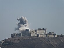
During the Syrian Civil War that began in 2011, UNESCO voiced concerns that the war might lead to the damage of important cultural sites such as Krak des Chevaliers.[50] It has been reported that the castle was shelled in August 2012 by the Syrian Arab Army, and the Crusader chapel has been damaged.[51] The castle was reported to have been damaged in July 2013 by an airstrike during the Siege of Homs,[52] and once more on 18 August 2013 it was clearly again damaged yet the amount of destruction is unknown. The Syrian Arab Army recaptured the castle and the village of al-Hosn from rebel forces on March 20, 2014. Since then, both the UNESCO and the Syrian government have produced periodic reports about the state of the site, required reconstruction and conservation measures, and advance in these.[53]
Architecture[edit]
Writing in the early 20th century, T. E. Lawrence, popularly known as Lawrence of Arabia, remarked that Krak des Chevaliers was “perhaps the best preserved and most wholly admirable castle in the world, [a castle which] forms a fitting commentary on any account of the Crusading buildings of Syria”.[54] Castles in Europe provided lordly accommodation for their owners and were centers of administration; in the Levant the need for defence was paramount and was reflected in castle design. Kennedy suggests that “The castle scientifically designed as a fighting machine surely reached its apogee in great buildings like Margat and Crac des Chevaliers.”[55]
Krak des Chevaliers can be classified both as a spur castle, due to its site, and after the 13th-century expansion a fully developed concentric castle. It was similar in size and layout to Vadum Jacob, a Crusader castle built in the late 1170s.[56] Margat has also been cited as Krak des Chevaliers’ sister castle.[57] The main building material at Krak des Chevaliers was limestone; the ashlar facing is so fine that the mortar is barely noticeable.[58] Outside the castle’s entrance was a “walled suburb” known as a burgus, no trace of which remains. To the south of the outer ward was a triangular outwork and the Crusaders may have intended to build stone walls and towers around it. It is unknown how it was defended at the time of the 1271 siege, though it has been suggested it was surrounded by a timber palisade.[59] South of the castle the spur on which it stands is connected to the next hill, so that siege engines can approach on level ground. The inner defences are strongest at this point, with a cluster of towers connected by a thick wall.
Inner ward[edit]
Between 1142 and 1170 the Knights Hospitaller undertook a building programme on the site. The castle was defended by a stone curtain wall studded with square towers which projected slightly. The main entrance was between two towers on the eastern side, and there was a postern gate in the northwest tower. At the center was a courtyard surrounded by vaulted chambers. The lay of the land dictated the castle’s irregular shape. A site with natural defences was a typical location for Crusader castles and steep slopes provided Krak des Chevaliers with defences on all sides bar one, where the castle’s defences were concentrated. This phase of building was incorporated into the later castle’s construction.[26]
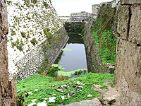
When Krak des Chevaliers was remodelled in the 13th century, new walls surrounding the inner court were built. They followed the earlier walls, with a narrow gap between them in the west and south which was turned into a gallery from which defenders could unleash missiles. In this area, the walls were supported by a steeply sloping glacis which provided additional protection against both siege weapons and earthquakes. Four large, round towers project vertically from the glacis; they were used as accommodation for the Knights of the garrison, about 60 at its peak. The southwest tower was designed to house the rooms of the Grand Master of the Knights Hospitaller. Though the defences which once crested the walls of the inner wards no longer survive in most places, it seems that they did not extend for the entire circuit. Machicolations were absent from the southern face. The area between the inner court and the outer walls was narrow and not used for accommodation. In the east, where the defences were weakest, there was an open cistern filled by an aqueduct. It acted both as a moat and water supply for the castle.[60]
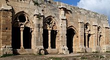
At the north end of the small courtyard is a chapel and at the southern end is an esplanade. The esplanade is raised above the rest of the courtyard; the vaulted area beneath it would have provided storage and could have acted as stabling and shelter from missiles. Lining the west of the courtyard is the hall of the Knights. Though probably first built in the 12th century, the interior dates from the 13th-century remodelling. The tracery and delicate decoration is a sophisticated example of Gothic architecture, probably dating from the 1230s.[61]
Chapel[edit]
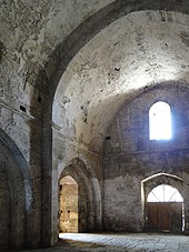
The current chapel was probably built to replace the one destroyed by an earthquake in 1170.[26] Only the east end of the original chapel, which housed the apse, and a small part of the south wall survive from the original chapel.[40] The later chapel had a barrel vault and an uncomplicated apse; its design would have been considered outmoded by contemporary standards in France, but bears similarities to that built around 1186 at Margat.[26] It was divided into three roughly equal bays. A cornice runs round the chapel at the point where the vault ends and the wall begins. Oriented roughly east to west, it was 21.5 metres (71 ft) long and 8.5 metres (28 ft) wide with the main entrance from the west and a second smaller one in the north wall. When the castle was remodelled in the early 13th century, the entrance was moved to the south wall. The chapel was lit by windows above the cornice, one at the west end, one on either side of the east bay, and one on the south side of the central bay, and the apse at the east end had a large window. In 1935 a second chapel was discovered outside the castle’s main entrance, however it no longer survives.[62]
Outer ward[edit]
The second phase of building work undertaken by the Hospitallers began in the early 13th century and lasted decades. The outer walls were built in the last major construction on the site, lending the Krak des Chevaliers its current appearance. Standing 9 metres (30 ft) high, the outer circuit had towers that projected strongly from the wall. While the towers of the inner court had a square plan and did not project far beyond the wall, the towers of the 13th-century outer walls were rounded. This design was new and even contemporary Templar castles did not have rounded towers.[33] The technique was developed at Château Gaillard in France by Richard the Lionheart between 1196 and 1198.[63] The extension to the southeast is of lesser quality than the rest of the circuit and was built at an unknown date. Probably around the 1250s a postern was added to the north wall.[64]
Arrow slits in the walls and towers were distributed to minimise the amount of dead ground around the castle. Machicolations crowned the walls, offering defenders a way to hurl projectiles towards enemies at the foot of the wall. They were so cramped archers would have had to crouch inside them. The box machicolations were unusual: those at Krak des Chevaliers were more complex that those at Saône or Margat and there were no comparable features amongst Crusader castles. However, they bore similarities to Muslim work, such as the contemporary defences at the Citadel of Aleppo. It is unclear which side imitated the other, as the date they were added to Krak des Chevaliers is unknown, but it does provide evidence for the diffusion of military ideas between the Muslim and Christian armies. These defences were accessed by a wall-walk known as a chemin de ronde. In the opinion of historian Hugh Kennedy the defences of the outer wall were “the most elaborate and developed anywhere in the Latin east … the whole structure is a brilliantly designed and superbly built fighting machine”.[65]
When the outer walls were built in the 13th century the main entrance was enhanced. A vaulted corridor led uphill from the outer gate in the northeast.[66] The corridor made a hairpin turn halfway along its length, making it an example of a bent entrance. Bent entrances were a Byzantine innovation, but that at Krak des Chevaliers was a particularly complex example.[67] It extended for 137 metres (450 ft), and along its length were murder-holes which allowed defenders to shower attackers with missiles.[66] Anyone going straight ahead rather than following the hairpin turn would emerge in the area between the castle’s two circuits of walls. To access the inner ward, the passage had to be followed round.[67]
Frescoes[edit]
Despite its predominantly military character, the castle is one of the few sites where Crusader art (in the form of frescoes) has been preserved. In 1935, 1955, and 1978 medieval frescoes were discovered within Krak des Chevaliers after later plaster and white-wash had decayed. The frescos were painted on the interior and exterior of the main chapel and the chapel outside the main entrance, which no longer survives. Writing in 1982, historian Jaroslav Folda noted that at the time there had been little investigation of Crusader frescoes that would provide a comparison for the fragmentary remains found at Krak des Chevaliers. Those in the chapel were painted on the masonry from the 1170–1202 rebuild. Mold, smoke, and moisture have made it difficult to preserve the frescoes. The fragmentary nature of the red and blue frescoes inside the chapel means they are difficult to assess. The one on the exterior of the chapel depicted the Presentation of Jesus at the Temple.[68]
ـــــــــــــــــــــــــــــــــــــــــــــــــــــــــــــــــــــــــــــــــــــــــــــــــــــــ
قلعة الحصن – حمص
| قلعة الحصن | |
|---|---|
|
قلعة الحصن في سوريا
|
|
|
|
|
| إحداثيات | 34.756944°N 36.294444°E |
| معلومات عامة | |
| الحالة | مدمر جزئياً |
| نوع المبنى | قلعة |
| الدولة | سوريا |
| المساحة | 2.38 هكتار، و37.69 هكتار |
| سنة التأسيس | 1031 |
| تاريخ الهدم | جزئي |
| المالك | المديرية العامة للآثار والمتاحف |
| المعايير | (ii) ، و(vi) |
| رقم التعريف | 1229-001 |
|
|
|
| التفاصيل التقنية | |
| المواد المستخدمة | حجر جيري |
| النمط المعماري | قوطي |
| المقاول الرئيسي | نصر بن صالح آل مرداس، وفرسان الإسبتارية |
قلعة الحصن (بالفرنسية: Krak des Chevaliers) هي قلعة كاثوليكية تعود لفترة الحروب الصليبية، تقع ضمن سلاسل جبال الساحل في محافظة حمص في سوريا، وتبعد عن مدينة حمص 60 كم، ونظرًا للأهمية التاريخية والعمرانية للحصن فقد اعتبرتها منظمة اليونسكو قلعة تاريخية هامة لاحتوائها على تراثٍ إنساني عظيم، وفي عام 2006 م سُجلت القلعة على لائحة التراث العالمي إلى جانب قلعة صلاح الدين الأيوبي [1]
تعتبر هذه القلعة بكونها واحدة من أهم قلاع القرون الوسطى المحفوظة في العالم، الموقع سكنه أولاً الأكراد الذين جلبهم الإدريسين في القرن الحادي عشر لحماية خطوط التجارة قبل التوصل إلى تسوية ؛[2] وكنتيجة لذلك فقد كانت تُعرف باسم حصن الأكراد، بمعنى “قلعة للأكراد“.[3][4]
في 1142، أُعطيت القلعة لريموند الثاني كونت طرابلس الذي حولها إلى “فرسان المشفى” وسبب التسمية إقامة حامية من المتطوعين لأعمال الطبابة إبان الحقبة الصليبية داخل القلعة، وقد بقيت في حوزته حتى سقطت في 1271م وأصبحت تعرف باسم كراك دو اوسبيتال (بالفرنسية: Crac de l’Ospital)؛ وقد صيغ الاسم إلى قلعة الحصن (بالفرنسية: Krak des Chevaliers) في القرن التاسع عشر.
الموقع
تقع القلعة في بلدة الحصن في منطقة وادي النصارى بمحافظة حمص، [5] إلى الجنوب من بلدة مشتى الحلو السياحية حيث تبعد عنها مسافة 30 كم.[6] وتتوسط مدينتي حمص وطرطوس،[7] وتعتبر القلعة من القلاع الأثرية الجميلة في الشرق الأوسط والعالم[8]. ترقد تلة عالية بارتفاع 650 متر (2,130 قدم) شرق طرطوس، سوريا، في “فجوة حمص” [6] .
أصل الأسم
الاسم الحالي هو قلعة الحصن، ومعناه بالعربية “قلعة المعقل”، وهو مستمد من اسم أحد الأسماء السابقة للقلعة والتي كانت تسمى «حصن الأكراد» ، ومعناه “معقل الأكراد “الذين سكنوا القلعة سابقاً.[9] وعند سيطرت الفرنجة على القلعة الكرك لفظت لي كرات .[10] ربما الاسم الفرنجي يعود نظقا لكلمة الأكراد. بعدما أُعطيت القلعة لفرسان المشفى اطلقوا عليها اسم كراك دي شوفالييه أي قلعة الحصن (Crac des Chevaliers) ، في القرن 19 التاسع عشر .[2]
التاريخ
يُعتقد أن القلعة أقيمت فوق أطلال قلعة أقدم منها كان اسمها «شبتون» أقامها الفراعنة عندما غزوا سوريا بقيادة رعمسيس الثاني في القرن الخامس عشر قبل الميلاد.[11] بالرغم من ان الآراميون سكنوا المنطقة منذ فترة طويلة إلا أنه ليس في هذا الحصن مايشير إلى وضع آرامي قديم ولكن ربما يعود في أساساته إلى العهود اليونانية وما بعد حيث يذكر بعض المؤرخون بأن اليونانيون بنوا معقلاً عسكرياً في المنطقة المتوسطة بين طرابلس وحمص وقد سماها اليونان بيرغاز (Pirgas)أي الحصن أو المعقل وتسرب هذا التعريف إلى العربية بكلمة “برج” لنفس المسمى.[بحاجة لمصدر] تعد قلعة الحصن نموذجاً كاملاً للقلاع العسكرية المحصنة اتخذت شكل مضلع غير منتظم طول قطره الكبير 200م والصغير 140م. تبلغ مساحتها 3 هكتار ، لم يستكمل بناء القلعة دفعة واحدة وإنما تم بناؤها على شكل مراحل مختلفة، فقد شيد المرداسيون الحصن عام 1031 من قبل شبل الدولة نصر بن صالح المرداسي فأقام فيها حصناً صغيراً كان هدفه حماية طريق القوافل التجارية القادمة من سواحل بلاد الشام إلى داخل بلاد الشام. وسكنوها الأكراد لحماية الطريق، ولذلك حملت اسم حصن الأكراد وأطلق عليها أيضاً حصن السفح أو الصفح والكرك ومن هذا الاسم اشتقت التسمية الصليبية للقلعة. بنيت القلعة لتكون نقطة مراقبة للقوافل في زمن المرداسيون، ولكن مع وصول حملات الصليبيين عام 1099 استولى على الحصن ريموند صنجيل ونهب محيطها من قرى ومزارع ثم استرجعها منه أمير حمص سنة 1102 وقام بعدها تانكرد صاحب أنطاكية عام 1110 بالاستيلاء عليها وفي 1144 قام ريموند الثاني أمير طرابلس بتسليمها إلى فرسان القديس يوحنا المعروفين بالإسبتارية أو فرسان المشفى والتي كانت طائفة من الرهبان المقاتلين والذين أعادوا بناء دفاعات جديدة للقلعة وعرفت بعدها باسم قلعة الفرسان Crack des Chevaliers وعرفت باللاتينية بإسم Cratom أو Castrum Crati ، ومنذ ذلك الحين بدأ المكان يعرف باسم حصن الفرسان (بالإنجليزية: Krak des Chevaliers)، وقد أعاد الإسبتارية بناء الدفاعات الجديدة للقلعة، وقاموا بترميمها بعد الزلزال الذي أصابها عام 1157 وتعد من أجمل القلاع العسكرية في الشرق، كما تعتبر أكبر قلعة عسكرية في العالم[بحاجة لمصدر]، فرض الفرنسيون شراءها من الحكومة السورية سنة 1926 ورمموها بغية إبقائها مُلكاً للحكومة الفرنسية. في سنة 1109 م هاجمها الصليبيون بقيادة أمير إنطاكبة Tancred واحتلها سنة 1110 م فأدركوا أهميتها وموقعها المتميز فعملوا على تحصينها وتزويدها بالمنشآت الدفاعية والمرافق الحيوية (كمستودعات الحبوب والزيت والفرن والمعصرة والطاحونة ومرابط الخيل وأقبية وأحواض وآبار الماء) التي تكفل صمودها أمام الحصارات لأطول وقت ممكن.
وقد حاول المسلمون استعادة القلعة عدة مرات فحاصرها سلطان حلب السلجوقي ألب أرسلان لفترة قصيرة سنة 1115 م ولم يستطع تحريرها.
تعرضت القلعة لزلزال عام 1157م والذي دمر أيضآ العديد من المباني في بلاد الشام، كما أصابها زلزال شديد عام 1169 م، فلم يبقى فيها سور قائم مما دعا الصليبيون لتجديدها ثانية وترميم الأجزاء المنهارة منها وزيادة تحصيناتها. قام العرب بمحاولات عدة لاستعادة القلعة فقد حاول السلطان نورالدين الزنكي تحرير القلعة مرتين عام 1163-1167 م، وقد جرت المعارك مع الصليبين في سهل البقيعة جنوب سرق القلعة، كما حاصرها السلطان صلاح الدين الأيوبي حوالي عام 1188م, أثناء مرور جيشه لاستعادة الساحل السوري دون تحريرها.
وفي عام 1201 م، أصاب القلعة زلزال ثالث مدمر أحدث فيها أضراراً واسعة وبعد هذا الزلزال بدأ الطور الثالث من إعمار القلعة نتجت عنه حلقة الدفاع الخارجية والجدار المنحدر الضخم في الجهة الجنوبية والمستودع خلف الواجهة الجنوبية.
قام السلطان المملوكي الملك الظاهر بيبرس بأول محاولة لتحرير القلعة من الصليبيين عام 1267 م، بعد أن حرر كل الحصون والأبراج المجاورة والقريبة منها كما قام بالهجوم مرة أخرى عام 1269 م.
أعد الملك الظاهر بيبرس العدة والعتاد لاقتحام القلعة وبدأ الحصار الرسمي للقلعة في شتاء عام 1271 م، الذي استمر عن شهر ونيف ومن ثم سقطت القلعة بيد الملك الظاهر بيبرس في 6 نيسان من العام نفسه بعد أن استسلم الفرسان مقابل خروجهم إلى طرابلس.
أمر السلطان الظاهر بيبرس بتجديد ماتهدم من القلعة ووضعها في الخدمة وجعلها مركزاً لنائب السلطنة فقام المماليك خلال هذه الفترة بإضافة أبراج ومنشآت وعلى الأخص في الواجهة الجنوبية التي تم تدعيمها بواسطة برج الملك الظاهر بيبرس كذلك أضاف السلطان سيف الدين قلاوون برج مستطيل ضخم بارز على الجهة الجنوبية للسور الخارجي ومؤرخ عام 1285م,كما أضافوا الحمامات وبعض الأجزاء الأخرى كالجهة الشرقية الشمالية، وقام حاكمها الجديد صارم الدين قايمار بأعمال إصلاح النطاق تحت الإشراف المستمر للسلطان الملك الظاهر بيبرس.
كانت القلعة ماتزال تستخدم حتى أواخر العصور الوسطى وفي الأزمنة الحديثة وكانت سليمة تقريباً في أوائل عام 1800 م. الشكل العام للقلعة بيضوي بحيث تنتد مع خندقها على مسافة 240 م من جهة الشمال إلى الجنوب و170م من جهة الشرق إلى الغرب وتقدر مساحتها الإجمالية بثلاث هكتارات أي 30 ألف متر مربع وتتسع لعدة آلاف من المقاتلين.
التاريخ الحديث
بعد طرد الفرنجة من الأراضي المقدسة عام 1291 ، وانخفاض الغزوات الأوروبية على المنظقة في الحروب الصليبية في القرن التاسع عشر، لم يكن أي فائدة في تجديد وترميم المباني ومنها قلعة الحصن، ولذلك لا يوجد اي خطط تفصيلية للقلعة قبل عام 1837. وكان غيوم ري أول باحث أوروبي قام بدراسة علميا القلاع الصليبية في الأراضي المقدسة ..[11] وفي عام 1871 قام بنشر دراسات عن القلاع الصليبية، وشملت دراسته خطط ورسومات للقلاع الصليبية الكبرى في سوريا، بما في ذلك قلعة الحصن .[12] زار بول ديشان القلعة في فبراير شباط سنة 1927. بعد ان زارها ري في القرن 19 وقد أنشئت قرية صغيرة داخل القلعة عدد سكانها كان 500 شخص .[13] حاول ديشان وزميله المهندس فرانسوا، القيام بمسح لأثار القلعة، وقام الجنرال الفرنسي موريس جيملين بتعيين 60 جنديا لمساعدة بعثت ديشان . غادر ديشان سوريا في مارس 1927 واستئنف العمل في القلعة بعد سنتين من عودته، وفي عام 1934 تم وضع خطط مفصلة لعملية ترميم القلعة . وصفها المؤرخ العسكري “دي .جي”(Derek J. Penslar) بأنها “رائعة وشاملة” حسب تقريره عام 1949 و”ربما أفضل تقيم للقلعة جاء من قبل مؤرخ هيو كينيدي في عام 1994.[2] في وقت مبكر عام 1929 كانت هناك اقتراحات بأن القلعة ينبغي أن تكون تحت السيطرة الفرنسية . وفي 16 نوفمبر 1933 تم تأجير قلعة الحصن لحكومة الانتداب الفرنسي، وتم نقل القرويين القاطنين في القلعة إلى محيطها ودفع مليون فرنك فرنسي كتعويضات لهم .[14] وعلى مدى العامين التاليين من تأجير أجري برنامج تنظيف وترميم من قبل قوة ضمت 120 عامل . وبمجرد الانتهاء، وكان قلعة الحصن واحدة من مناطق الجذب السياحي الرئيسية في بلاد الشام في عهد السيطرة الفرنسية .[15] المهندس بيير غوبيل كان المشرف على أعمال الصيانة للقلعة وهو نفسه الذي كان أيضا مشرف على أعمال الصيانة في برج لي ليونز وقلعتين اثنتين في صيدا .[15] ومع انتهاء الانتداب الفرنسي على سوريا في عام 1946 وإعلان الاستقلال السوري .[16] عدت من قبل منظمة اليونسكو احدى مواقع التراث العالمي، جنبا إلى جنب مع قلعة صلاح الدين في عام 2006 ،[3] القلعة حاليا مملوكة من قبل الحكومة السورية . وخلال الأحداث السورية الاخيرة والتي بدأت في عام 2011 عبرت اليونسكو عن مخاوف من أن النزاع قد يؤدي إلى الضرر في المواقع الثقافية الهامة مثل قلعة الحصن .[17] وقد أفيد أن القلعة تعرضت للضرر في آب 2012 من خلال الاشتباكات الدائرة بين الجيش الحكومي والمعارضة المسلحة، وقد سجل تضرر الكنيسة الصليبية فيها.[18][19][20]
العديد من سكان القلعة السابقين قامو ببناء منازلهم خارج القلعة في قرية تسمى الحصن .[18] عدد سكان القرية يبلغ من ما يقرب من 9,000 نسمة، يستفيدون بشكل مباشر اقتصاديا من السياحة والنشاطات التي تقام في الموقع.[18][19][20]
تواريخ تبادل السيطرة على القلعة
- 1163 – نور الدين زنكي يلتقي جيوش الفرنجة في سهل البقيعة ولكنه يخفق في استرداد القلعة.
- 1166 – محاولة فاشلة أخرى لنور الدين الزنكي لاسترداد القلعة.
- 1170 – زلزلة جديدة تدمر القلعة وتهدم الأسوار، ثم لا يلبث الفرنجة أن يعيدوا بناءها وبناء الكنيسة.
- 1188 – صلاح الدين الأيوبي يحاصر القلعة لمدة شهر بعد أنتصاره في معركة حطين وذلك أثناء مرور جيشه لاستعادة الساحل السوري.
- 1202 – زلزال ثالث مدمر تبعه إعادة إعمار القلعة ولا سيما حلة الدفاع الخارجية والجدار المنحدر في الجنوب والمستودع الكائن خلف الواجهة الجنوبية..
- 1206 – أحد أشقاء صلاح الدين يحاول احتلال القلعة دون جدوى.
- 1230 – بناء برج القائد في الطابق العلوي.
- 1250 – تشييد قاعة الفرسان الكبرى والرواق الذي يتقدمها.
- 1255 – تشييد البرج الدفاعي المتقدم عند المدخل الشمالي للقلعة على يد نيكولا لورني.
- 1270 – الملك الظاهر بيبرس يحاصر القلعة ولكنه يعود مسرعًا إلى مصر للتصدي لحملة الملك لويس التاسع الفرنسي.
- 1271 – الظاهر بيبرس يعود ليحاصر القلعة وينصب المجانيق مقابل السور الجنوبي بتاريخ 2 آذار وينجح باسترداد القلعة يوم 8 نيسان وتصبح القلعة منطلقًا لتحرير قلعة المرقب التي حررها قلاوون عام 1285.
- 1285 – الناصر محمد بن قلاوون الصالحي المملوكي ينشئ البرج المربع الضخم على وسط البرج الجنوبي.
- 2012 – سيطرت عليها المعارضة السورية وتعرض بعض أجزاء قلعة الحصن لبعض الضرر نتيجة الاشتباكات القتالية القائمة في سوريا بين الحكومة ومعارضيها.[21][22]
- 2014 20 مارس استعادتها الجمهورية السورية بعد انسحاب المعارضة منها والمناطق المحيطة بها
الوصف
تعتبر قلعة الحصن من أهم الأوابد الأثرية والتاريخية والمعمارية في سورية وهي من أهم قلاع القرون الوسطى وأضخمها وأشهرها في العالم وأفضلها محافظة على بنائها حتى يومنا هذا وتتميز بهندستها العسكرية وقوة تحصيناتها الدفاعية. فهي تتميز ببنائها وزخارفها الرائعة وبجدرانها وأبراجها العالية ودهاليزها ومقاذيفها وشقوق مرامي السهام وسلسلة من شرفاتها البارزة بحيث تحمل مزيجآ من حضارات الشرق والغرب في فن العمارة.
فالقلعة تنتصب فوق هضبة بركانية نهاية سلسلة جبال الساحل شديدة الانحدار من جهاتها الثلاث مما يجعل اقتحامها صعباً جداً، ترتفع عن سطح البحر 750 م وعلى بعد60 كيلو مترًا غرب مدينة حمص فهي بذلك تحتل موقعاً استراتيجياً هاماً ومتوسطاً بين حمص وطرابلس وطرطوس وبحكم هذا الموقع الهام تسيطر على ممر القوافل التجارية والعسكرية بين الساحل والداخل. تمتدّ القلعة مع خندقها على مسافة 240 مترًا من الشمال إلى الجنوب و170 مترًا من الشرق إلى الغرب. وتُقدّر مساحتها بثلاثة هكتاراتٍ، وتتكوّن من حصنَين داخليّ وخارجيّ، بينهما خندق وحولهما خندق يُشرف عليها جميعًا قصر تحميه أبراج. وتتّسع القلعة لحاميةٍ تعدادها ما ينوف عن ثلاثة آلاف محارب مع عتادهم وخيولهم ومُؤونهم. وكانت تشغل موقعاً متميزاً من أجل مراقبة تحركات الجيوش وصد هجماتها فمن أبراجها العالية يمكن مشاهدة برج صافيتا والبحر غرباً وجبال عكار جنوباً (أي أن القلعة تقع شمال لبنان)ويمكن مشاهدة بحيرة قطينة وأطراف مدينة حمص شرقاً. موقع القلع في وسط سوريا في وادي النظارة جعلها مركز استراتيجي وعسكري هام فوقوفها فوق ذروة مرتفعة تزيد عن 2100 قدم، وهي على اتصال بالنظر مع (القصر الأبيض) برج صافيتا. وتشرف على محور “حمص-طرابلس” أهم المحاور بين الداخل والساحل السوري وأكبرها، ورممت القلعة جزئيا في الأعوام الأخيرة وهي واحدة من أفضل نماذج التحصينات الفرنجية في المشرق حيث توجد قناة مائية قدت في الصخر وتعزل القلعة عن الجرف الممتد باتجاه الجنوب وتتألف من حلقتين متحدتي المركز من التحصينات وموصولتين بمدخل طويل منحدر والحلقة الخارجية مضلعة إهليلجية الشكل تتألف من سور يحوي عددا من الشرفات الدفاعية ومقواة بحصون بارزة نصف دائرية. يحرس البوابة الثانوية الصغيرة في الواجهة الشمالية حصنان بارزان ملاصقان لهما تماما وأما الواجهة الشرقية فقد عدلت كثيرا تحت الحكم العربي ويحرس هذا الجناح ثلاث حصون بارزة مستطيلة الشكل صغيرة يحوي إحداها المدخل الرئيسي أما القطاع الذي تعرض لأكبر تعديل على يد العرب المسلمين فهو الواجهة الجنوبية الدفاعية للقلعة وبالأصل كانت مؤلفة من سور واق تحميه حصون بارزة نصف دائرية وشرفة مقواة متواصلة ولكنها عززت بعد عام 1285 م ببرج السلطان قلاوون ويحوي البرج الدائري في الزاوية الجنوبية غرفة حسنة التجهيز تعرف باسم (مأوى السيد).
البنية
- تمتاز القلعة بلون حجارتها الكلسية التي كانت تجلب من مسافة / 4 كم / من بلدة مجاورة تدعى / عمار الحصن / وميزة الحجر الكلسي أنه طيع أثناء النحت وخفيف الوزن.
- تبلغ المساحة الإجمالية للقلعة حوالي / 30000 م2 / وترتفع القلعة عن سطح البحر حوالي / 750 م /
كتبت باللغة اللاتينية على أحد جدران القلعة حكمةً تقول:
«إذا مُنحت النعمة، ومُنِحت الحكمة وفوقها الجمال. لا تدع التعجرف يقترن بها لأنه يذهب بها جميعاًَ».
خطوط الدفاع
الخندق المائي الخارجي
خندق المائي الخارجي والذي يحيط بكامل القلعة من الخارج، ويشكل خط دفاعي أول للقلعة.تهدم الجزء الكبير من الخندق ولكن ما زالت بعض اثاره قائمة.[23]
الحصن الداخلي
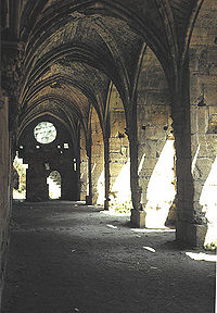
دير قوطي في فناء القلعة
- الحصن الداخلي هو قلعة قائمة بذاتها يحيط بها خندق يفصلها عن السور الخارجي، ولها بوابة رئيسية تتصل بباب القلعة الخارجي بواسطة دهليز طويل ينحدر تدريجيًا حتى الباب مؤلفًا منعطفًا دفاعيًا في منتصفه. ولهذا الحصن ثلاثة أبواب مفتوحة على الخندق، ويمتاز بأبراجه العالية. ويتألف من طابقين. الأرضي ويضم فسحة سماوية تحيط بها الأقبية والعنابر وقاعة الاجتماعات، والكنسية والمطعم والحجرات والمعاصر. والعلوي ويحتوي على أسطح مكشوفة ومهاجع وأبراج. أما الخندق المحيط به فمحفور في الصخر، سلطت عليه أقنية تحمل إليه مياه الأمطار.
- السور الداخلي للقلعة يتألف من خمسة أبراج دفاعية وحامية للسور الداخلي,
خندق مائي يفصل بين السورين الداخلي والخارجي يبلغ طوله قرابة / 70 م.
الحصن الخارجي
- الحصن الخارجي هو السور الخارجي للقلعة وهو حصن قائم بذاته، يتألف من عدة طوابق. فيه القاعات والإصطبلات والمستودعات وغرف الجلوس. مزود بـ13 برجًا بعضها دائري وبعضها مربع أو مستطيل، وهو محاط بخندق.
- السور الخارجي للقلعة يتألف من ثلاثة عشر برجاً دفاعياً وحامية للسور الداخلي.
الخندق المائي الداخلي
والذي يفصل بين الحصن الخارجي والداخلي وهو يحيط بالقلعة من الداخل ولايزال القسم الجنوبي منه قائماً حتى الآن وتتجمع فيه مياه الأمطار.ويوجد فيه عدة أبواب تؤدي إلى الحصن الخارجي بواسطة جسور خشبية متحركة والأبواب بعضها معلق وبعضها الآخر يتصل بسراديب ضيقة تؤدي إلى الداخل تستخدم عند الحاجة.
أقسام القلعة
- قاعة الفرسان المتميزة بالفن القوطي.
- الكنيسة التي تم تحويلها في العهود الإسلامية إلى مسجد.
- المخازن التي تخزن فيها المؤونة للجنود ويوجد فرن دائري الشكل لصناعة الخبز.
- مهاجع نوم الجنود.
- المسرح وهو ذي شكل دائري.
- الأبراج العلوية وفيها برج قائد الفرسان وبرج قائد القلعة وهو البرج الوحيد المبني على شكل دائري.
- برج بنت الملك وهو الآن مستثمر كاستراحة ومطعم للسياح.
- قاعة الحرس المملوكي.
الكنيسة

الطرف الشرقي من القلعة يظهر السقف المقبب للكنيسة الصغيرة
الكنيسة الحالية ربما بنيت لتحل محل كنيسة قديمة دمرها الزلزال في عام 1170.[24] يضم الطرف الشرقي من الكنيسة الأصلي، المحراب وجزء صغير من الجدار الجنوبي المتبقي من الكنيسة الأصلية .[24] يشبه تصميم الكنيسة الحالية المعايير القديمة التي كانت متبعة في فرنسا ببناء الكنائس، ولكن رغم التشابه فإن بناء هذه الكنيسة يعودإلى حوالي سنة 1186 [19 ] وتم تقسيمها إلى ثلاثة خلجان متساوية تقريبا . إفريز يعمل على مدار مصلى عند النقطة التي تنتهي عند العقادةو تبدأ بجدار . واتجاه الكنيسة نحو الشرق الغربي تقريبا، مع ارتفاع 21.5 متر (71 قدم) ، الكنيسة لها مدخل رئيسي واسع من جهة الغرب وأخر أصغر في الجدار الشمالي . عندما أعيد تخطيط القلعة في القرن 13th في وقت مبكر، وتم نقل المدخل الجدار الجنوبي .[24] كانت إضائة الكنيسة تتم من قبل نوافذ بنيت فوق إفاريز، مقسمة لثلاث مجموعات واحدة في الطرف الغربي، وواحدة على كل جانب من جهة الشرق، ومجموعة على الجانب الجنوبي في الوسط، وكان يوجد في المحراب في الطرف الشرقي نافذة كبيرة أيضا. في عام 1935 تم اكتشاف مصلى ثاني خارج المدخل الرئيسي للقلعة.[25]
مهرجان القلعة
يقام في رحاب القلعة مهرجان غنائي سنوي، فالقلعة حاليا هي مركز جذب سياحي عالمي وتقام فيها المهرجانات الغنائية والمسرحية على مسرح القلعة .[26] كما تم تصوير عدد من المسلسلات التاريخية في رحاب القلعة .[27] وتزامنا مع مهرجان القلعة يتم فيها أيضا افتتاح سوق المهن والتقاليد الشعبية، وملتقى التشكيل
.


